 |
|
 11.12.2010, 05:16
|
#1 |
|
Пользователь
Регистрация: 16.06.2009
Сообщений: 43
|
I have taken a break from the Belarus map while I am waiting for a new, more powerful computer. My old computer was having problems populating the map.
While I am waiting, I am modifying the old YCJ_Ukraine map. I have taken out the smaller rivers. I have also re-created the Dnepr as it was in the 1940's before the hydro-electric projects. I consulted old maps to get the appropriate information. As well, some other canals and lakes which were not in existence in the 1940's have also been removed. I have cut the map just south of Dnepropetrovsk and Kirovograd in the north and just east of Odessa in the west to make it smaller and easier to load and populate. I am going to re-do the coastline and make it "smoother" and less "square". As well, I will perform the same process to some of the rivers and lakes from the original YCJ_Ukraine map. The map is currently flyable, but I am not happy with the basic map_c and will make many further changes. 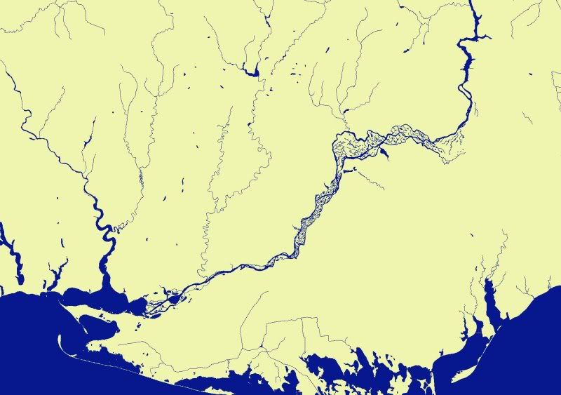
|

|

|
| Здесь присутствуют: 1 (пользователей: 0 , гостей: 1) | |
|
|


 Древовидный вид